Take a scenic drive through the Blue Ridge Mountains on this loop route that winds through Pisgah National Forest, past trails and waterfalls, lakes and overlooks.
With beautiful views in spring, summer and fall — parts of this route could be closed in winter — this 86-mile loop is a great introduction to the area’s many attractions and destinations.
Plan for at least 2.5 hours of driving, plus plenty of time to stop and see the sights along the way. This scenic drive begins and ends in Little Switzerland, but since it’s a loop, you can choose any starting point along the route.
Click here to see the full Lake James Loop through the Pisgah National Forest drive on Google Maps.
What You’ll See On Your Drive
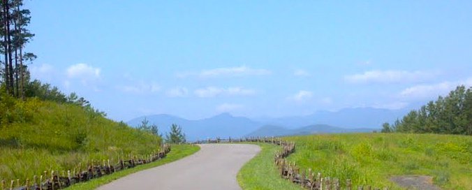
Begin on the Blue Ridge Parkway in Little Switzerland (at Milepost 334) and head south for about 10 miles. You’ll see one of the Parkway’s 26 iconic tunnels and several overlooks. Pull over at the Three Knobs Overlook (Milepost 338.8; elevation 3,875 ft.) for a sweeping west-facing view. Don’t miss stunning Crabtree Falls at Milepost 339.5 — a 3-mile hike will take you to the base of this 60-foot cascade.
Exit the Blue Ridge Parkway at NC Hwy 80. Turn left (northbound) to visit the nearby overlook for the Eastern Continental Divide (elevation is 3,350 ft), or take a 2.5-mile detour to see nearby Roaring Fork Creek Falls. When you’re ready to continue the drive, head south on NC Hwy 80 to begin the winding descent known as the Devil’s Staircase. Over the next 12 miles, you’ll pass trout farms, campgrounds and picturesque Lake Tahoma.
Turn left at the T-intersection with US Hwy 70. Travel about 2 miles to US Hwy 221 Business, passing thie Historic Carson House and the Joseph McDowell Historical Catawba Greenway. Turn right to take a detour into historic downtown Marion.
Turn left onto US Hwy 221 Business, then make a right turn onto Hankins Rd. After about 3.4 miles, turn left onto Lake James Road and follow along the north shore of Lake James. You’ll pass the Black Bear boat access and the Bear Creek Marina, which is open seasonally for casual lakefront dining and live music with a view.
Turn right onto South Mountain Institute Road, and travel about 2 miles before turning left onto NC Hwy 126 East. Travel about 5.6 miles as you pass trailheads for the Fonta Flora State Trail and another boat access ramp.
Turn left onto Fish Hatchery Road and travel about 5 miles. On weekdays, consider a stop at the Table Rock Fish Hatchery, one of North Carolina’s coolwater hatcheries where trout, bass, walleye and musellunge are raised in 17 ponds.
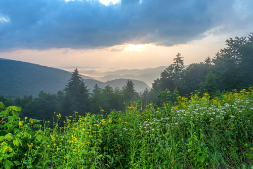
Turn left onto Rose Creek Road, and travel for 2 miles on this backcountry dirt road. Then turn left onto NC Hwy 181. Travel for about 15 miles, passing the beautiful Brown Mountain Overlook (elevation 2,760 ft.).
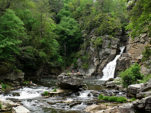
Turn left onto NC Hwy 183, driving west. After about 4 miles, you’ll enter the Linville Gorge Wilderness Area, home to the “Grand Canyon of the East” and the popular Linville Falls. It’s definitely worth a stop to snap a photo and hike around the falls.
Turn right onto US Hwy 221, then look for the entrance to the Blue Ridge Parkway on your right. At the top of the ramp, turn right to head south along the Parkway. As you travel the 16 or so miles back toward Little Switzerland, you’ll pass several more overlooks. Stop at the Historic Orchard at Altapass for some old-time music and fresh apple pie, and learn about the history of mining at the Museum of North Carolina Minerals.